Active GNSS [Global Navigation Satellite System] Network (gnssnet.hu)
Datasets
Land Registry, Geodesy and Surveying
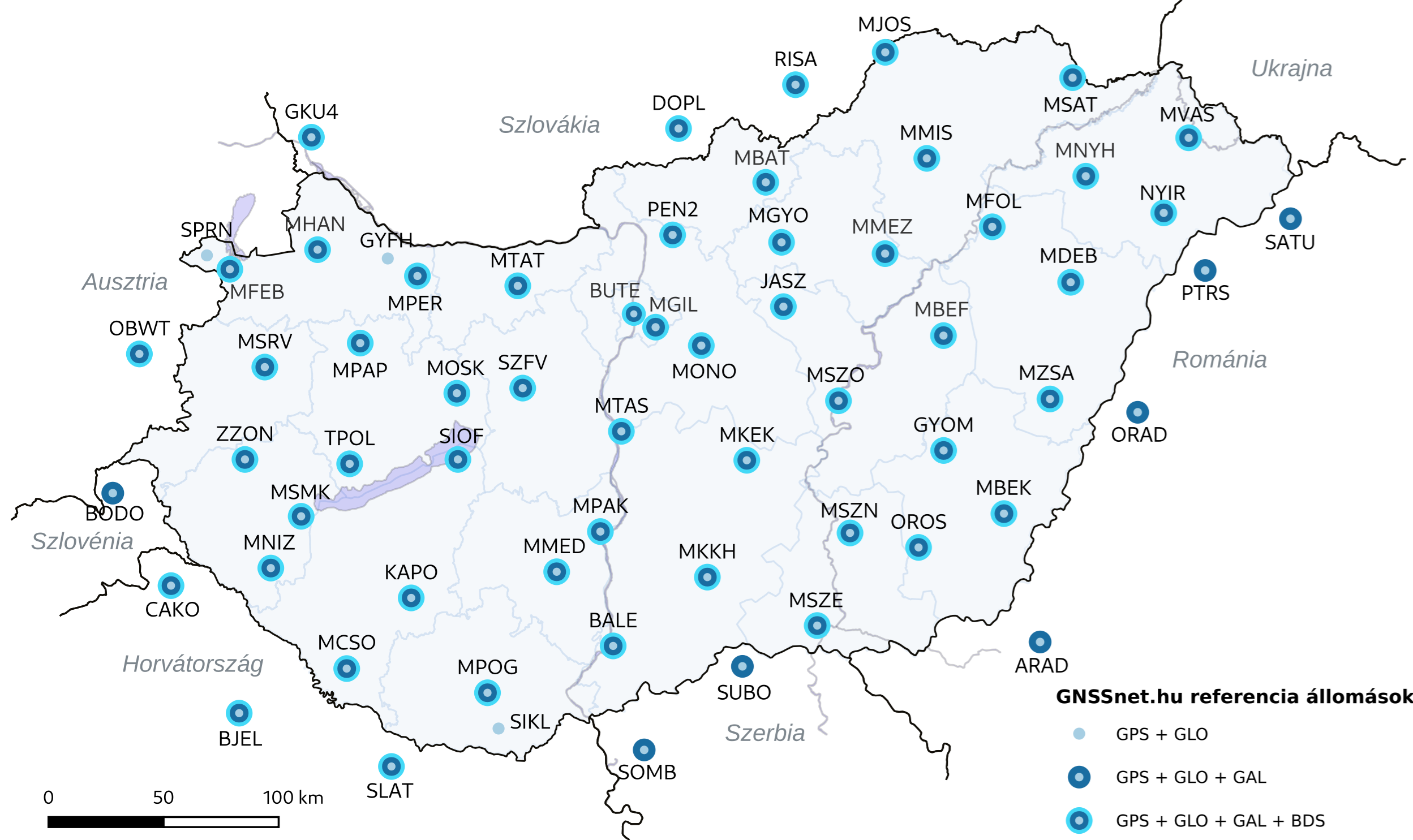
Consists of evenly distributed GNSS reference stations across Hungary, providing data for high-precision satellite positioning.
What does it contain?
The GNSS network consists of reference stations installed at approximately 60 km intervals, providing continuous multi-GNSS (GPS/GLONASS/Galileo/BeiDou) observations. The data enable high-precision satellite positioning both in real time and through post-processing.