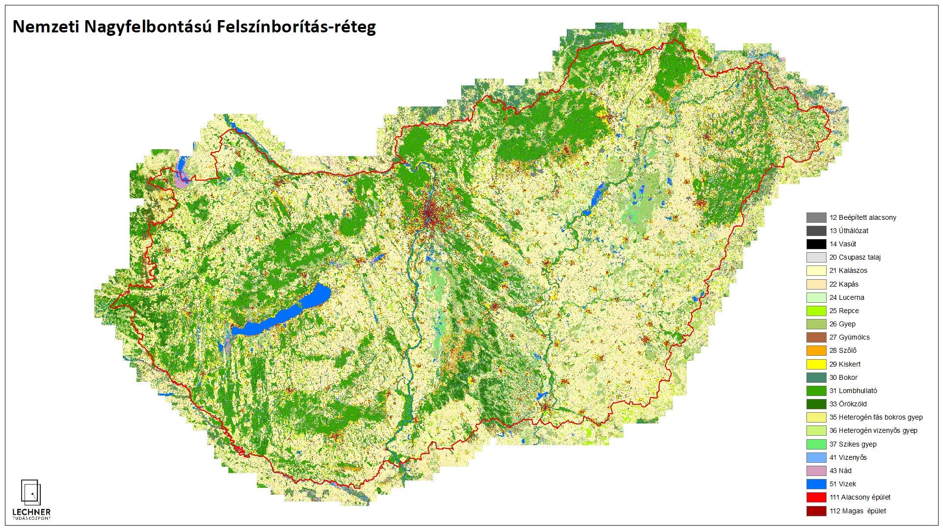
National High Resolution Land Cover
Datasets
Remote sensing
A 10x10-meter thematic raster layer provides information on land cover and, to a certain extent, land use.
What does it contain?
Thanks to the large volume of freely accessible satellite imagery provided by the Sentinel satellites, we can obtain information on a given area for multiple periods throughout the year. By processing these satellite images using new machine learning methods, we can create more reliable databases on land cover characteristics than ever before. The annual NHRL layers aim to present the most up-to-date characteristics of a given year, based on the results of data integration and visual controls.