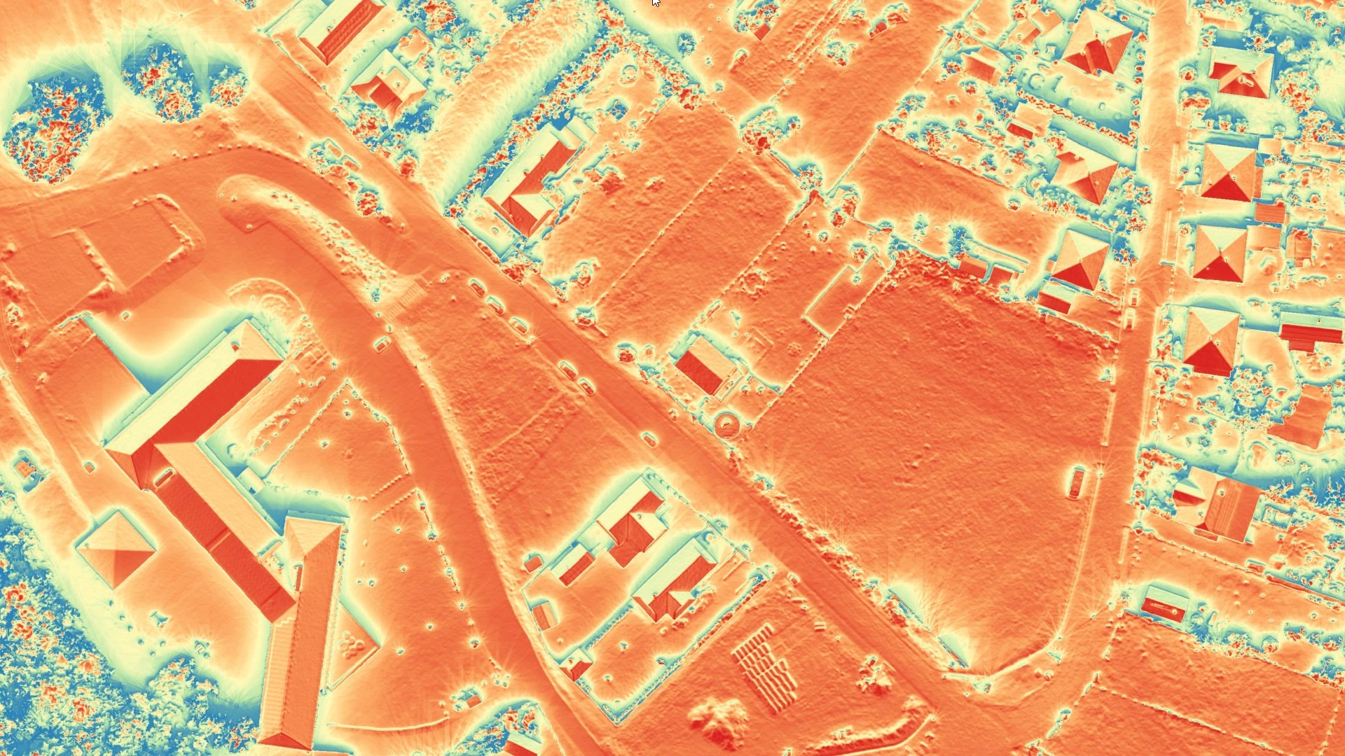
Solar Potential Mapping
A geospatial analysis that utilizes 3D models to simulate light and shadow conditions, providing an accurate assessment of a specific area's solar energy potential.
Problem description
Prior to the installation of solar farms or even citizen-initiated individual solar panel systems, there is a genuine need to determine the optimal location or the proper positioning of the system based on the annual trajectory of the sun and the specific topographical conditions of the site. A Solar Potential Map can facilitate this process.
Solution workflow
Our geospatial team executes advanced solar irradiance computations by integrating bare-earth Digital Terrain Models (DTM), absolute Digital Surface Models (DSM), and 3D vector building geometries (LOD1, LOD2). Leveraging specialized software to model the sun's annual apparent motion and the precise shading dynamics of surrounding topographical and structural features, we calculate the exact per-square-meter solar energy yield incident upon specific roof planes or broad terrain expanses (e.g., slopes and hillsides).
Output
A pixel-level dataset (typically a regular grid) that displays the estimated solar energy yield for specific surfaces, often visualized using a color scale.